-
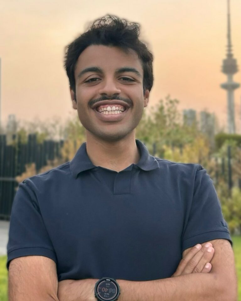
Data Diversity Podcast #5 – Abdulwahab Alshallal
Welcome back to another edition of the Data Diversity Podcast, the Research Data podcast from the University of Cambridge Office of Scholarly Communication (OSC). If this is your first time here, in this podcast, I speak to Cambridge Data Champions about their journeys in acquiring and working with data in their research, with the hope to highlight interesting facets of data work, but also academic research in general. In this episode, I spoke to Cambridge PhD student Abdulwahab Alshallal, from the MRC Epidemiology Unit, and who is part of the Physical Activity Epidemiology research group. Currently for his PhD, he is exploring associations of physical activity, behaviour and fitness…
-
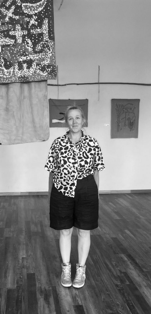
Data Diversity Podcast (#4) – Dr Stefania Merlo (2/2)
We return with another post featuring our Data Diversity conversation with University of Cambridge Data Champion, archaeologist Dr Stefania Merlo from the McDonald Institute of Archaeological Research, the Remote Sensing Digital Data Coordinator and project manager of the Mapping Africa’s Endangered Archaeological Sites and Monuments (MAEASaM) project and coordinator of the Metsemegologolo project. This post is short in word count but not in importance, as it touches on two reflections on the challenges of data management as a researcher who works in a global context, two aspects of present-day academia that may be relevant to many readers. This edition follows on from the previous post where Stefania talks about the challenges of extending UK-based Open…
-
The Research Data Sustainability Workshop – November 2024
The rapid advance of computing and data centres means there is an increasing amount of generated and stored research data worldwide, leading to an emerging awareness that this may have an impact on the environment. Wellcome have recently published their Environmental sustainability policy, which stipulates that any Wellcome funded research projects must be conducted in an environmentally sustainable way. Cancer Research UK have also updated their environmental sustainability in research policy and it is anticipated that more funders will begin to adopt similar policies in the near future. In November we held our first Research Data Sustainability Workshop in collaboration with Cambridge University Press & Assessment (CUP&A). The aim was…
-
Data Diversity Podcast (#4) – Dr Stefania Merlo (1/2)
Welcome back to the fourth instalment of Data Diversity, the podcast where we speak to Cambridge University Data Champions about their relationship with research data and highlight their unique data experiences and idiosyncrasies in their journeys as a researcher. In this edition, we speak to Data Champion Dr Stefania Merlo from the McDonald Institute of Archaeological Research, the Remote Sensing Digital Data Coordinator and project manager of the Mapping Africa’s Endangered Archaeological Sites and Monuments (MAEASaM) project and coordinator of the Metsemegologolo project. This is the first of a two-part series and in this first post, Stefania shares with us her experiences of working with research data and outputs that…
-
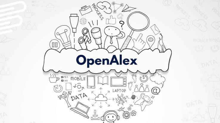
Towards enriched open scholarly information: integrating DSpace and OpenAlex
We are pleased to announce that, thanks to the support of the Vietsch Foundation, we will be developing an integration between DSpace repositories and OpenAlex. We are partnering with 4Science, a certified platinum DSpace provider, to deliver this project that will integrate two key systems within the global scholarly ecosystem, the DSpace repository (https://www.dspace.org/) and OpenAlex (https://openalex.org/), a free and open catalogue of the world’s scholarly research system. Using OpenAlex’s open API (Application Programming Interface), this integration will allow for the quick import of relevant research and scholarly (meta)data into DSpace repositories, helping institutions to improve the quality and completeness of their records of research outputs and streamlining researcher publication…
-
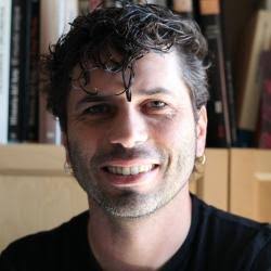
Data Diversity Podcast #3 – Dr Nick H. Wise (3/4)
Welcome back to the penultimate post featuring Dr Nick H. Wise, Research Associate in Architectural Fluid Mechanics at the Department of Engineering, University of Cambridge. If you have been with us for the previous two posts, you would know that besides being a scientist and an engineer, Nick has made his name as a scientific sleuth who, based on an article on the blog Retraction Watch which was written in 2022, is responsible for more than 850 retractions, leading Times Higher Education to dub him as a research fraudbuster. Since then, through his X account @Nickwizzo, he has continued his investigations, tracking cases of fraud and in some cases, naming…
-
Data Diversity Podcast #3 – Dr Nick H. Wise (1/4)
In our third instalment of the Data Diversity Podcast, we are joined by Dr Nick H. Wise, Research Associate in Architectural Fluid Mechanics at the Department of Engineering, University of Cambridge. As is the theme of the podcast, we spoke to Nick about his experience as a researcher, but this is a special edition of the podcast. Besides being a scientist and an engineer, Nick has made his name as a scientific sleuth who, based on an article on the blog Retraction Watch which was written in 2022, is responsible for more than 850 retractions, leading Times Higher Education to dub him as a research fraudbuster. Since then, through his…
-
Data Diversity Podcast #2 – Dr Alfredo Cortell-Nicolau
In our second instalment of the Data Diversity Podcast, we are joined by archaeologist Dr Alfredo Cortell-Nicolau, a Senior Teaching Associate in Quantitative and Computational Methods in Archaeology and Biological Anthropology at the McDonald Institute for Archaeological Research and Data Champion. As is the theme of the podcast, we spoke to Alfredo about his relationship with data and learned from his experiences as a researcher. The conversation also touched on the different interpersonal, and even diplomatic, skills that an archaeologist must possess to carry out their research, and how one’s relationship with individuals such as landowners and government agents might impact their access to data. Alfredo also sheds light on…
-
Mapping the world through data – The November 2023 Data Champion Forum
The November Data Champion forum was a geography/geospatial data themed edition of the bi-monthly gathering, this time hosted by the Physiology department. As usual, the Data Champions in attendance were treated to two presentations. Up first was Martin Lucas-Smith from the Department of Geography who introduced the audience to the OpenStreetMap (OSM) project, a global community mapping project using crowdsourcing. Just as Wikipedia is for textual information, OSM results in a worldwide map created by everyday people who map the world themselves. The resulting maps can vary in terms of its focus such as the transport map, which is a map which shows public transport lanes like railways, buses and…
-
US requirements for public access to research
Niamh Tumelty, Head of Open Research Services, Cambridge University Libraries Yesterday it was announced that the White House Office of Science and Technology Policy has updated US policy guidance to make the results of taxpayer-supported research immediately available to the American public at no cost: https://www.whitehouse.gov/ostp/news-updates/2022/08/25/ostp-issues-guidance-to-make-federally-funded-research-freely-available-without-delay/ Federal agencies have been asked to update their public access policies to make publications and supporting data publicly accessible without an embargo. This applies to all federal agencies (the previous policy only applied to those with more than $100 million in annual research and development expenditure) and allows for flexibility for the agencies to decide on some of the details while encouraging alignment of…